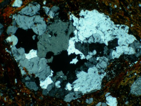
In other news, Concepcion, Chile is now sitting ten feet further west than it did previous to the magnitude 8.8 earthquake.
Only about 3.1 meters displacement, you say? For one event, that is pretty damn significant. That and in the grand scheme of things, there's only a smidgen of crustal shortening and subduction going on there. Amazing to think about how much ocean crust once did exist there before the subduction zone developed. But alas, as the ridge is still actively spreading, the crust must go somewhere!
Something about that whole conservation of mass thing . . .
Then there's this article about Mars. Cool. One of the great questions about Mars is centered around what controlled the erosional and sedimentary features on the planet's surface and what happened to it.
Mars' surface yields some spotty paleomagnetic evidence of possible early plate tectonics (I like to think so, at least. However, it's not universally accepted and other models exist), but it's plainly evident that whatever the tectonic style of the planet, it shut down while Earth was still in the Precambrian Eon (I guess it's considered a "Supereon"?). Mars is just too small to maintain plate tectonics/convection cycles like those of Earth - the heat gradient from core to surface is too steep. I could talk all day about what I think about the formation of the giant shield volcanoes and Tharsis, but that's not what the article's about. Well, it could tie into Tharsis. But it's not directly about it.
Later on, sedimentary features developed - most strikingly, the canyons larger than any found on Earth. Whatever fluids and erosional processes that once controlled this are mostly gone now. It's now being postulated in this article that some of the channel features were carved out by lava.
I can buy this - camped in Snow Canyon State Park in Utah a couple of years ago. It admittedly started as a canyon carved by fluvial (waterflow-driven) processes, but was located proximal to a basaltic magma source as young as 20,000 years old. Eruptions there changed the course of the river - partly by building up topography in some places and carving it out in others. Redirection of waterways carved new, deeper canyons and remnants of older lava flows can be seen near the top of the present day canyon. This is a phenomenon called "inverted topography," where younger rock sits lower than older rock. This is only one way to form inverted topography, but that could be a blog post in and of itself, so maybe I'll save that for another post.
Showing posts with label utah. Show all posts
Showing posts with label utah. Show all posts
Monday, March 8, 2010

Saturday, March 6, 2010
I Love Geology, Yes I Do!
It's a monocline that looks like a SHIP! I hope everyone else sees that too!

This is a picture from the start of the San Rafael Swell in Utah. A monocline is sort of like an anticline (convex fold), except it only has one leg. It tells us that the area was undergoing some sort of uneven compression that caused one side to kink up and form a leg, while the other side slooooowly tapers downward to gradually merge with the rest of the Colorado Plateau. Note that this area is only a tiny part of the Swell itself. When we camped on the monocline in 2008, we were only still part of civilization in that we were staying in a campground. No facilities or water, though - we had to bring everything in and pack it all out.
One of the cool things we discussed at field camp while we were camping up on the Swell is that evidence of hydrocarbons exists in the sandstone beds of the monocline. Before erosive forces carved out the Little Grand Canyon and other features, this has been interpreted to be one of the largest hydrocarbon reservoirs ever to have existed. If I remember correctly, it was thought to contain more barrels of oil than sources in Saudi Arabia. Once the entrapping rocks were cut through during erosion, though, the hydrocarbons drained away to who-knows-where. They're long gone and broken down.
I'll dig out a few more photos with time. I've taken a TON of pictures on my field excursions in the past couple of years, downloaded them, looked at a few, and forgotten about more than I've looked at. Perhaps a massive reorganization/cataloguing project is in order.
Or, knowing me, maybe not! Regardless, I've been coming across some fun shots with stories behind them and it would be only best if I were to share them.

This is a picture from the start of the San Rafael Swell in Utah. A monocline is sort of like an anticline (convex fold), except it only has one leg. It tells us that the area was undergoing some sort of uneven compression that caused one side to kink up and form a leg, while the other side slooooowly tapers downward to gradually merge with the rest of the Colorado Plateau. Note that this area is only a tiny part of the Swell itself. When we camped on the monocline in 2008, we were only still part of civilization in that we were staying in a campground. No facilities or water, though - we had to bring everything in and pack it all out.
One of the cool things we discussed at field camp while we were camping up on the Swell is that evidence of hydrocarbons exists in the sandstone beds of the monocline. Before erosive forces carved out the Little Grand Canyon and other features, this has been interpreted to be one of the largest hydrocarbon reservoirs ever to have existed. If I remember correctly, it was thought to contain more barrels of oil than sources in Saudi Arabia. Once the entrapping rocks were cut through during erosion, though, the hydrocarbons drained away to who-knows-where. They're long gone and broken down.
I'll dig out a few more photos with time. I've taken a TON of pictures on my field excursions in the past couple of years, downloaded them, looked at a few, and forgotten about more than I've looked at. Perhaps a massive reorganization/cataloguing project is in order.
Or, knowing me, maybe not! Regardless, I've been coming across some fun shots with stories behind them and it would be only best if I were to share them.
Friday, January 9, 2009
Upheaval Dome
MSU Geology Club visited Upheaval Dome during Spring Break last year (first week of March). It's interesting because it's one of the rare naturally-forming circular surface structures seen around the world, and debate has raged for years over what formed it. Two popular explanations prevail.
One hypothesis suggests that it is the remnants of and uplifting salt dome, eroded away presumably during the uplift of the Colorado Plateau, which the dome and surrounding Canyonlands are a part of.
Another hypothesis suggests the structure is an impact crater. Evidence for this (in my opinion) is particularly sparse. Obviously the shape and structure make it a prime candidate for impact crater consideration. Shocked quartz was recently found in the crater, though according to teh Wiki (noncited statement as far as I could tell), there may not have been more than a few grains found, and they were located off-center, which is interpreted by pro-impact types as evidence of an oblique impact. Shatter cones have also been found within the crater, which provide strong evidence for an impact. However, when the club was there, we spent an extensive amount of time debating the issue.
Points of Contention:
1. Uplift/deformation. The very definition of "dome." I don't know much about uplift of rock layers with impact structures in general, but it seems a bit too regular for an impact, especially an oblique impact as suggested by the impact proponents.
2. Lack of fracturing. Impact bodies general travel at speeds in the neighborhood of 10-15 km/s. To put it lightly, at that speed, an impact will not cause rock to bend - rock will fracture. Violently. Some upward "bending" might be possible on the impact rebound around the sides of the crater. Hard to say. I'm running impact models in my head, and as much as I like to pretend I'm a computer, I'm not. There would definitely be fragmentation, fracturing, and other forms of violent deformation on a large scale. Naked eye observation from a height doesn't really reveal that.
3. Shocked quartz (As opposed to normal quartz). Shocked quartz is formed only by high-impact events. In fact, the only types of events known to produce shocked quartz are asteroid/comet impacts and nuclear bomb detonations. I need to look up more reports about the volume of shocked quartz found at the site. Discovery News reported its discovery in Upheaval Dome right about the time the Geology Club spent our break on the Colorado Plateau and visited the Dome. The only source that gives a mention of the volume found is the Wiki article on Upheaval Dome, which claims that "only a few grains" of shocked quartz have been found. The Websites cited in that article are indeterminate with regard to volume of shocked quartz present. If there's significant shocked quartz, then sure, I'll go with the impact hypothesis. If not, we just can't know.
4. Shatter cones. These structures are often form beneath impact sites and radiate outward. They provide decent evidence for impact as well, but in some cases are tough to distinguish from slickensides.
Based on the current evidence, We have no effing clue what this circular structure is. I'm leaning toward salt dome for now. Read up on it and make your own decision.
One hypothesis suggests that it is the remnants of and uplifting salt dome, eroded away presumably during the uplift of the Colorado Plateau, which the dome and surrounding Canyonlands are a part of.
Another hypothesis suggests the structure is an impact crater. Evidence for this (in my opinion) is particularly sparse. Obviously the shape and structure make it a prime candidate for impact crater consideration. Shocked quartz was recently found in the crater, though according to teh Wiki (noncited statement as far as I could tell), there may not have been more than a few grains found, and they were located off-center, which is interpreted by pro-impact types as evidence of an oblique impact. Shatter cones have also been found within the crater, which provide strong evidence for an impact. However, when the club was there, we spent an extensive amount of time debating the issue.
Points of Contention:
1. Uplift/deformation. The very definition of "dome." I don't know much about uplift of rock layers with impact structures in general, but it seems a bit too regular for an impact, especially an oblique impact as suggested by the impact proponents.
2. Lack of fracturing. Impact bodies general travel at speeds in the neighborhood of 10-15 km/s. To put it lightly, at that speed, an impact will not cause rock to bend - rock will fracture. Violently. Some upward "bending" might be possible on the impact rebound around the sides of the crater. Hard to say. I'm running impact models in my head, and as much as I like to pretend I'm a computer, I'm not. There would definitely be fragmentation, fracturing, and other forms of violent deformation on a large scale. Naked eye observation from a height doesn't really reveal that.
3. Shocked quartz (As opposed to normal quartz). Shocked quartz is formed only by high-impact events. In fact, the only types of events known to produce shocked quartz are asteroid/comet impacts and nuclear bomb detonations. I need to look up more reports about the volume of shocked quartz found at the site. Discovery News reported its discovery in Upheaval Dome right about the time the Geology Club spent our break on the Colorado Plateau and visited the Dome. The only source that gives a mention of the volume found is the Wiki article on Upheaval Dome, which claims that "only a few grains" of shocked quartz have been found. The Websites cited in that article are indeterminate with regard to volume of shocked quartz present. If there's significant shocked quartz, then sure, I'll go with the impact hypothesis. If not, we just can't know.
4. Shatter cones. These structures are often form beneath impact sites and radiate outward. They provide decent evidence for impact as well, but in some cases are tough to distinguish from slickensides.
Based on the current evidence, We have no effing clue what this circular structure is. I'm leaning toward salt dome for now. Read up on it and make your own decision.
Friday, June 6, 2008

Subscribe to:
Posts (Atom)