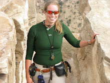
The ones I've done/seen are in bold. Comments are in italic.
1. See an erupting volcano
2. See a glacier - Seen some cirqes and glacial valleys
3. See an active geyser such as those in Yellowstone, New Zealand or the type locality of Iceland - Old Faithful and Steamboat, plus a few other unnamed ones near Yellowstone Lake.
4. Visit the Cretaceous/Tertiary (KT) Boundary. Possible locations include Gubbio, Italy, Stevns Klint, Denmark, the Red Deer River Valley near Drumheller, Alberta. - Driven over it a few times, but have never stopped and looked for iridium-red layers.
5. Observe (from a safe distance) a river whose discharge is above bankful stage
6. Explore a limestone cave. Try Carlsbad Caverns in New Mexico, Lehman Caves in Great Basin National Park, or the caves of Kentucky or TAG (Tennessee, Alabama, and Georgia) Been to Carlsbad, NM and Cueva del Hato, Curaçao
7. Tour an open pit mine, such as those in Butte, Montana, Bingham Canyon, Utah, Summitville, Colorado, Globe or Morenci, Arizona, or Chuquicamata, Chile. Visited a rehabilitating open pit mine in Elko, NV
8. Explore a subsurface mine.
9. See an ophiolite, such as the ophiolite complex in Oman or the Troodos complex on the Island Cyprus (if on a budget, try the Coast Ranges or Klamath Mountains of California).
10. An anorthosite complex, such as those in Labrador, the Adirondacks, and Niger (there's some anorthosite in southern California too).
11. A slot canyon. Many of these amazing canyons are less than 3 feet wide and over 100 feet deep. They reside on the Colorado Plateau. Among the best are Antelope Canyon, Brimstone Canyon, Spooky Gulch and the Round Valley Draw. Hiked several in Death Valley
12. Varves, whether you see the type section in Sweden or examples elsewhere.
13. An exfoliation dome, such as those in the Sierra Nevada. - Maybe. I've definitely seen a lot of Sierra Nevada laccoliths.
14. A layered igneous intrusion, such as the Stillwater complex in Montana or the Skaergaard Complex in Eastern Greenland. - Does writing an emergency LMI lecture count?
15. Coastlines along the leading and trailing edge of a tectonic plate.
16. A gingko tree, which is the lone survivor of an ancient group of softwoods that covered much of the Northern Hemisphere in the Mesozoic. There are several on the street where my mom lives
17. Living and fossilized stromatolites (Glacier National Park is a great place to see fossil stromatolites, while Shark Bay in Australia is the place to see living ones) Marquette, MI
18. A field of glacial erratics
19. A caldera - Yellowstone plus just about all of the San Juan calderas, also known as my master's project field area.
20. A sand dune more than 200 feet high - I think the big one in Death Valley's about that large. If not, it's close.
21. A fjord
22. A recently formed fault scarp Outside of SLC, UT, if within the past 200ish years counts
23. A megabreccia
24. An actively accreting river delta
25. A natural bridge Natural Bridge, IN and the Natural Bridge in Death Valley (want to say it's related to Golden Canyon??)
26. A large sinkhole
27. A glacial outwash plain
28. A sea stack
29. A house-sized glacial erratic
30. An underground lake or river
31. The continental divide - Hiked up above the treeline in June 2009 and saw Uncompahgre Peak about ten miles off. There are some incredible views in the Divide region of the San Juans and Colorado. Also drove across it numerous times on the way to and from field camp.
32. Fluorescent and phosphorescent minerals We have more than a few in my building, given IL's state mineral is fluorite!
33. Petrified trees Not in-situ - pulled some out of some rock layers out West and we have part of a tree trunk in NHB
34. Lava tubes Snow Canyon, UT and a small one preserved in the Precambrian(!) basalts of Mamainse Point
35. The Grand Canyon. All the way down. And back. Little Grand Canyon of the San Rafael Swell doesn't count, does it?
36. Meteor Crater, Arizona, also known as the Barringer Crater, to see an impact crater on a scale that is comprehensible - Been to Upheaval Dome, which I think was recently discovered to harbor shocked quartz . . .
37. The Great Barrier Reef, northeastern Australia, to see the largest coral reef in the world.
38. The Bay of Fundy, New Brunswick and Nova Scotia, Canada, to see the highest tides in the world (up to 16m)
39. The Waterpocket Fold, Utah, to see well exposed folds on a massive scale.
40. The Banded Iron Formation, Michigan, to better appreciate the air you breathe. Been once, going back in May and VERY excited for it!
41. The Snows of Kilimanjaro, Tanzania.
42. Lake Baikal, Siberia, to see the deepest lake in the world (1,620 m) with 20 percent of the Earth's fresh water.
43. Ayers Rock (known now by the Aboriginal name of Uluru), Australia. This inselberg of nearly vertical Precambrian strata is about 2.5 kilometers long and more than 350 meters high
44. Devil's Tower, northeastern Wyoming, to see a classic example of columnar jointing - WANT TO!!!
45. The Alps.
46. Telescope Peak, in Death Valley National Park. From this spectacular summit you can look down onto the floor of Death Valley - 11,330 feet below. - Close(ish) - been to "Dante's View" at about 5600 feet. Gorgeous.
47. The Li River, China, to see the fantastic tower karst that appears in much Chinese art
48. The Dalmation Coast of Croatia, to see the original Karst.
49. The Gorge of Bhagirathi, one of the sacred headwaters of the Ganges, in the Indian Himalayas, where the river flows from an ice tunnel beneath the Gangatori Glacier into a deep gorge.
50. The Goosenecks of the San Juan River, Utah, an impressive series of entrenched meanders.
51. Shiprock, New Mexico, to see a large volcanic neck
52. Land's End, Cornwall, Great Britain, for fractured granites that have feldspar crystals bigger than your fist.
53. Tierra del Fuego, Chile and Argentina, to see the Straights of Magellan and the southernmost tip of South America.
54. Mount St. Helens, Washington, to see the results of recent explosive volcanism.
55. The Giant's Causeway and the Antrim Plateau, Northern Ireland, to see polygonally fractured basaltic flows.
56. The Great Rift Valley in Africa.
57. The Matterhorn, along the Swiss/Italian border, to see the classic "horn". Have seen the "Matterhorn" in the San Juans!
58. The Carolina Bays, along the Carolinian and Georgian coastal plain
59. The Mima Mounds near Olympia, Washington
60. Siccar Point, Berwickshire, Scotland, where James Hutton (the "father" of modern geology) observed the classic unconformity
61. The moving rocks of Racetrack Playa in Death Valley - Still sad we couldn't talk our petrologist emeritus extraordinaire to let us go!
62. Yosemite Valley
63. Landscape Arch (or Delicate Arch) in Utah - Better yet in early March, when it was cold, windy, a bit snowy, and outright miserable, which meant we got the most INCREDIBLE shots because no one else was crazy enough to be there when we were!
64. The Burgess Shale in British Columbia
65. The Channeled Scablands of central Washington
66. Bryce Canyon - Seen it from afar. It was still too cold/snowy at its elevation to make a visit there worthwhile.
67. Grand Prismatic Spring at Yellowstone - While a storm was moving into Yellowstone. Pulled off some gorgeous shots that afternoon as well as a nearly flawless pan of the Spring!
68. Monument Valley
69. The San Andreas fault
70. The dinosaur footprints in La Rioja, Spain
71. The volcanic landscapes of the Canary Islands
72. The Pyrennees Mountains
73. The Lime Caves at Karamea on the West Coast of New Zealand
74. Denali (an orogeny in progress)
75. A catastrophic mass wasting event - Mapped a crapton of landslides in the Wasatch-Uintas during field camp!
76. The giant crossbeds visible at Zion National Park - Aeolian deposits and they are STUNNING!
77. The black sand beaches in Hawaii (or the green sand-olivine beaches)
78. Barton Springs in Texas
79. Hells Canyon in Idaho
80. The Black Canyon of the Gunnison in Colorado
81. The Tunguska Impact site in Siberia
82. Feel an earthquake with a magnitude greater than 5.0. - Technically yes; woke up the morning of the Illinois earthquake in 2008, but don't remember which time I woke up specifically to some strange stimulus. I was in East Lansing, MI at the time.
83. Find dinosaur footprints in situ - Nope, just the teaching sample from GEOL 107
84. Find a trilobite (or a dinosaur bone or any other fossil) - Got a bitty-bite on a field trip I drove for last semester, but left it in the university SUV. : ( Good thing I still have a map to that locale!
85. Find gold, however small the flake - I don't think the gold-, silver-, and pyrite-bearing vein material we were allowed to poke around in during a field camp project counts . . .
86. Find a meteorite fragment
87. Experience a volcanic ashfall - If I were to experience this, it's probably mean I was too close to the eruption!
88. Experience a sandstorm - Seen a few dust devils outside of Vegas. : D
89. See a tsunami - Totally counting watching the tsunami-cams from CBS Hilo yesterday!
90. Witness a total solar eclipse - Almost. We had a near-total eclipse during school when I was in second grade. I got to watch the whole thing because my mom is awesome and brought in material to allow my class to watch it safely.
91. Witness a tornado firsthand. Unfortunately no, but it's one of my life's goals. I've seen a couple of funnel/wall clouds and an actual DOUBLE ANVIL cloud east of the Front Range in Colorado.
92. Witness a meteor storm, a term used to describe a particularly intense (1000+ per minute) meteor shower - This sounds awesome!
93. View Saturn and its moons through a respectable telescope. Have seen Saturn, plus Jupiter and the four Galilean moons. Awesomeness.
94. See the Aurora borealis, otherwise known as the northern lights. Thought it was a cloud refracting a remnant of sunlight till my dad recognized it for what it was.
95. View a great naked-eye comet, an opportunity which occurs only a few times per century Hyakutake in 1996 and Hale-Bopp in 1997.
96. See a lunar eclipse - Seen several; one during Sparty Watch
97. View a distant galaxy through a large telescope - Finally saw Andromeda with naked eye in Big Bend National Park almost exactly a year ago!!
98. Experience a hurricane
99. See noctilucent clouds - Think I have a couple of times; once during a night drive to the U.P. which couldn't be explained by anything else.
100. See the green flash - Been watching Lake Superior sunsets most of my life, watching for the Green Flash. Finally saw one in Curaçao and had a massive geekgasm in front of EVERYONE. If I remember correctly, the trip videographer caught the entire sunset on camera and hopefully didn't have the microphone on!
Sunday, February 28, 2010

Thoughts on Yesterday
Watched the online CBS stream coming out of the local station in Hilo yesterday afternoon, where the station's traffic cameras had been pointed seaward, attempting to capture live video of incoming tsunami waves.
Needless to say, it was a success! The camera looking across Hilo Bay had some of the best views - it was somewhat incredible to watch water quickly drain out of the bay, then back in 3-4 times. Thankfully it wasn't enough to cause much damage (pretty sure some was reported here and there, but minimal - things like docks here and there), but enough that it was easily observable.
The 2004 Sumatra earthquake was unique in that the resulting tsunami was captured in satellite images before it hit the islands. This one managed to supplant that first as we had the time to prepare, get everyone near coastal areas of the island chain calmly evacuated, and someone like me could sit on my couch in Illinois and watch the waves come in at the same time as folks in Hawaii. Scientists also proved that their models, technology, and warning system WORK. Sure, the scientists who developed the tsunami propagation models are itching to refine their programs and datasets, but we know that their model so far is fairly accurate. I believe arrival of the first tsunami was within a half an hour or so of the predicted arrival, and even before then, many people familiar with the prevailing ocean patterns around the islands could tell that there were some funky things happening prior to actual surge arrivals.
The coverage on tape is simply unprecedented. I like to think that earthquake and tsunami science took a huge step forward yesterday.
Also, here's some decent data on all of the major earthquakes since 1900. The deadliest earthquakes list is interesting and strange if not that it's more of a function of building style and location of population centers than earthquake strength. (And, at risk of making a controversial statement, humanity's intelligence with regard to building what we do where we do.)
Needless to say, it was a success! The camera looking across Hilo Bay had some of the best views - it was somewhat incredible to watch water quickly drain out of the bay, then back in 3-4 times. Thankfully it wasn't enough to cause much damage (pretty sure some was reported here and there, but minimal - things like docks here and there), but enough that it was easily observable.
The 2004 Sumatra earthquake was unique in that the resulting tsunami was captured in satellite images before it hit the islands. This one managed to supplant that first as we had the time to prepare, get everyone near coastal areas of the island chain calmly evacuated, and someone like me could sit on my couch in Illinois and watch the waves come in at the same time as folks in Hawaii. Scientists also proved that their models, technology, and warning system WORK. Sure, the scientists who developed the tsunami propagation models are itching to refine their programs and datasets, but we know that their model so far is fairly accurate. I believe arrival of the first tsunami was within a half an hour or so of the predicted arrival, and even before then, many people familiar with the prevailing ocean patterns around the islands could tell that there were some funky things happening prior to actual surge arrivals.
The coverage on tape is simply unprecedented. I like to think that earthquake and tsunami science took a huge step forward yesterday.
Also, here's some decent data on all of the major earthquakes since 1900. The deadliest earthquakes list is interesting and strange if not that it's more of a function of building style and location of population centers than earthquake strength. (And, at risk of making a controversial statement, humanity's intelligence with regard to building what we do where we do.)
Saturday, February 27, 2010
Okay . . . I'm Back
I was thinking about doing pancakes for breakfast last night, but because I'm still finding info online, 1. no pancakes, I'm eating cereal instead; and 2. I'm not going to get that much work done today. I'll get some done, but probably not till after we get some initial tsunami reports from Hawaii.
List of places under tsunami warning from NOAA. (text only)
One of my favorite people to follow on Twitter, @BadAstronomer, just RTed a very cool picture predicting the spread of the earthquake's energy worldwide (credit NOAA):

List of places under tsunami warning from NOAA. (text only)
One of my favorite people to follow on Twitter, @BadAstronomer, just RTed a very cool picture predicting the spread of the earthquake's energy worldwide (credit NOAA):

Megathrust Earthquake Offshore Maule, Chile, Magnitude 8.8
Wow. This is what happens when I decide to sleep in!
The map says 8.6 because that was the original calculated magnitude; it was revised up to 8.8 a short time after. Revisions are possible because as more time passes, more seismic stations worldwide pick up readings from the earthquake. The more seismic readings, the better scientists can analyze the nature of the earthquake and how it travels through the earth.
The beach ball today is oriented differently than the one from Japan that I described yesterday. You see a colored segment surrounded by white segments. Colored quarters of these spheres represent compression, and white quarters represent extension tension.
With a compression segment centered like this between two white segments, it's indicative of compression along the fault, or a thrust fault.
Sounds like there was a 9 foot tsunami and less than 100 confirmed dead so far. Expect these numbers to rise. My e-mail inbox is flooded with notifications of the aftershocks coming in above magnitude 5.0. The largest one so far was 6.9, and apparently as of now the tsunami warning worldwide has expanded. I expect the tsunami elsewhere could well be bigger.

As screwy as it might be, geologists get REALLY geeked out when this happens. While we hate to see death tolls, especially like what we saw with the Port-Au-Prince earthquake in January (I was in Curaçao when that happened - we didn't feel it then because we were on a dive when it would've shaken the island), the geology FASCINATES us. Earthquake prediction and mitigation is an inexact science at best. Typically, quake-prone places we know the most about have frequent, small earthquakes, like some parts of California. Those aren't places we're as worried about. The places we DO worry about are the ones where faults are quiet for a very long time, building up massive amounts of stress, then release it all at once. Since there are fewer, less frequent quakes there, we can't know as much about them.
The difference in quake frequency from place to place, even along the San Andreas Fault in California, is based in many things: structure and strength of the country rocks, their tendency toward ductile or brittle deformation under high pressure, hardness of constituent minerals (e.g. feldspar (H=6) vs. serpentine (H<2.5)), and nature/rate of movement along the fault running through the rocks.
I'm not even going to get started about some of the comments I saw on CNN's article about the Japan quake yesterday, nor the ones I'll undoubtedly be reading today. The level to which this country's lack of education about natural risks is astounding. Maybe I'll post a few gems later.
Since it's 10 am and I've been fielding earthquake data back and forth with some of my fellow scientists and I haven't yet had breakfast, I'm out.
The map says 8.6 because that was the original calculated magnitude; it was revised up to 8.8 a short time after. Revisions are possible because as more time passes, more seismic stations worldwide pick up readings from the earthquake. The more seismic readings, the better scientists can analyze the nature of the earthquake and how it travels through the earth.
The beach ball today is oriented differently than the one from Japan that I described yesterday. You see a colored segment surrounded by white segments. Colored quarters of these spheres represent compression, and white quarters represent extension tension.
With a compression segment centered like this between two white segments, it's indicative of compression along the fault, or a thrust fault.
Sounds like there was a 9 foot tsunami and less than 100 confirmed dead so far. Expect these numbers to rise. My e-mail inbox is flooded with notifications of the aftershocks coming in above magnitude 5.0. The largest one so far was 6.9, and apparently as of now the tsunami warning worldwide has expanded. I expect the tsunami elsewhere could well be bigger.

As screwy as it might be, geologists get REALLY geeked out when this happens. While we hate to see death tolls, especially like what we saw with the Port-Au-Prince earthquake in January (I was in Curaçao when that happened - we didn't feel it then because we were on a dive when it would've shaken the island), the geology FASCINATES us. Earthquake prediction and mitigation is an inexact science at best. Typically, quake-prone places we know the most about have frequent, small earthquakes, like some parts of California. Those aren't places we're as worried about. The places we DO worry about are the ones where faults are quiet for a very long time, building up massive amounts of stress, then release it all at once. Since there are fewer, less frequent quakes there, we can't know as much about them.
The difference in quake frequency from place to place, even along the San Andreas Fault in California, is based in many things: structure and strength of the country rocks, their tendency toward ductile or brittle deformation under high pressure, hardness of constituent minerals (e.g. feldspar (H=6) vs. serpentine (H<2.5)), and nature/rate of movement along the fault running through the rocks.
I'm not even going to get started about some of the comments I saw on CNN's article about the Japan quake yesterday, nor the ones I'll undoubtedly be reading today. The level to which this country's lack of education about natural risks is astounding. Maybe I'll post a few gems later.
Since it's 10 am and I've been fielding earthquake data back and forth with some of my fellow scientists and I haven't yet had breakfast, I'm out.
Friday, February 26, 2010
Ryukyu Island Earthquake Magnitude 7.0
Struck at 20:31 UTC. The map below shows that it was a strike-slip quake, or two tectonic plates sliding past each other. Two other types of earthquake typically involve a vertical component; either two plates running into each other or apart from each other.

USGS quake information here.

USGS quake information here.
Thursday, February 25, 2010


Kamchatcka Aerial

Subscribe to:
Posts (Atom)